WMTS (Beispiel JPEG)
URL: https://mapsneu.wien.gv.at/wmts/lb1938/grau/google3857/12/1419/2234.jpeg
Dataset description:
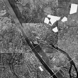
Der Luftbildplan von Wien aus dem Jahr 1938 deckt das gesamte Wiener Stadtgebiet in einer Auflösung von 20 Zentimeter ab. Die Luftbildbefliegung fand im Oktober und November 1938 statt....
Source: Luftbildplan 1938 Wien
Additional Information
| Field | Value |
|---|---|
| Data last updated | unknown |
| Metadata last updated | November 5, 2025 |
| Created | unknown |
| Format | JPEG |
| License | No License Provided |
| Created | 8 months ago |
| Issued | 10 years ago |
| Media type | image/jpeg |
| Modified | 2 years ago |
| Uri | https://www.data.gv.at/katalog/distributions/819052c4-4bb3-4c05-9f6e-fdd542516d33 |
| Access url | https://mapsneu.wien.gv.at/wmts/lb1938/grau/google3857/12/1419/2234.jpeg |
| Datastore active | False |
| Datastore contains all records of source file | False |
| Distribution ref | https://www.data.gv.at/katalog/distributions/819052c4-4bb3-4c05-9f6e-fdd542516d33 |
| Has views | True |
| Id | 8852abed-d34a-4666-9487-e04317a037c1 |
| License | https://creativecommons.org/licenses/by/4.0/ |
| Package id | cbd1ffbd-3997-43ed-af38-328db0dfaa6b |
| Position | 3 |
| State | active |