WMTS (Beispiel JPEG)
URL: https://mapsneu.wien.gv.at/wmts/lb/farbe/google3857/12/1419/2234.jpeg
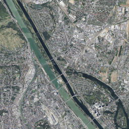
Dataset description:
Der Luftbildplan von Wien aus dem Jahr 1986 deckt das gesamte Wiener Stadtgebiet ab. Die Schwarz-Weiß-Bilder haben eine Auflösung von 50 Zentimeter. Die Luftbildbefliegung fand am 2....
Source: Luftbildplan 1986 Wien
Additional Information
| Field | Value |
|---|---|
| Data last updated | unknown |
| Metadata last updated | November 5, 2025 |
| Created | unknown |
| Format | JPEG |
| License | No License Provided |
| Created | 7 months ago |
| Issued | 1 year ago |
| Media type | image/jpeg |
| Modified | 1 year ago |
| Uri | https://www.data.gv.at/katalog/distributions/b4cbd18d-1b31-4503-95e8-58c2f438dc91 |
| Access url | https://mapsneu.wien.gv.at/wmts/lb/farbe/google3857/12/1419/2234.jpeg |
| Datastore active | False |
| Datastore contains all records of source file | False |
| Distribution ref | https://www.data.gv.at/katalog/distributions/b4cbd18d-1b31-4503-95e8-58c2f438dc91 |
| Has views | True |
| Id | d14da315-ea08-4672-b071-773bbef10851 |
| License | https://creativecommons.org/licenses/by/4.0/ |
| Package id | 22d9f8c9-86de-47db-8113-0e52492aeb9a |
| Position | 2 |
| State | active |